Difference between revisions of "Saddle Island, South Orkney Islands"
| Line 2: | Line 2: | ||
|name=Saddle Island | |name=Saddle Island | ||
|territory=British Antarctic Territory | |territory=British Antarctic Territory | ||
| − | |||
|latitude=-60.616 | |latitude=-60.616 | ||
|longitude=-44.833 | |longitude=-44.833 | ||
| + | |map=Saddle Island (ringed) - South Orkney Islands, BAT.svg | ||
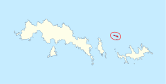
| + | |map caption=Saddle Island (ringed) | ||
|group=South Orkney Islands | |group=South Orkney Islands | ||
|area= | |area= | ||
Revision as of 14:50, 21 May 2022
| Saddle Island | |
| Location | |
| Location: | 60°36’58"S, 44°49’59"W |
| Data | |
Saddle Island is an island among the South Orkney Islands, part of the British Antarctic Territory.
The island is nearly two miles long, consisting of twin summits which are almost separated by a narrow channel strewn with boulders. It lies five and a half miles north of the west end of Laurie Island.
Saddle was discovered and charted in 1823 by British sealer James Weddell, and named by him for its distinctive twin-humped shape.
Outside links
- Gazetteer and Map of The British Antarctic Territory: Saddle Island, South Orkney Islands
References
| The South Orkney Islands, in the British Antarctic Territory |
|---|
|
Ailsa Craig • Coronation Island • Fredriksen Island • Governor Islands • Inaccessible Islands • Larsen Islands • Laurie Island • Lynch Island • Moe Island • Oliphant Islands • Powell Island • Robertson Islands • Saddle Island • Signy Island • Weddell Islands |
