Difference between revisions of "River Glass, Inverness-shire"
From Wikishire
(Created page with "River Glass near Struy The '''River Glass''' ({{lang|gd|Abhainn Ghlais}}) is a river in Inverness-shire...") |
|||
| Line 1: | Line 1: | ||
| + | {{county|Inverness-shire}} | ||
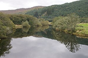
[[File:River Glass at Struy - geograph.org.uk - 1007008.jpg|thumb|River Glass near Struy]] | [[File:River Glass at Struy - geograph.org.uk - 1007008.jpg|thumb|River Glass near Struy]] | ||
The '''River Glass''' ({{lang|gd|Abhainn Ghlais}}) is a river in [[Inverness-shire]] which flows north-eastwards down [[Strathglass]]. It begins at the confluence of the [[River Affric]] and the Abhainn Deabhag, near the village of [[Tomich]]. It is joined by the [[River Cannich]] near the village of [[Cannich]], then flows as far as a confluence with the [[River Farrar]] near [[Struy]], from which point the merged waters are known as the [[River Beauly]].<ref>Ordnance Survey 1:50,000 scale Landranger map sheet 26 ''Inverness''</ref><ref>Ordnance Survey 1:25,000 scale Explorer</ref><ref>Ordnance Survey 1:10,000 scale StreetView</ref> | The '''River Glass''' ({{lang|gd|Abhainn Ghlais}}) is a river in [[Inverness-shire]] which flows north-eastwards down [[Strathglass]]. It begins at the confluence of the [[River Affric]] and the Abhainn Deabhag, near the village of [[Tomich]]. It is joined by the [[River Cannich]] near the village of [[Cannich]], then flows as far as a confluence with the [[River Farrar]] near [[Struy]], from which point the merged waters are known as the [[River Beauly]].<ref>Ordnance Survey 1:50,000 scale Landranger map sheet 26 ''Inverness''</ref><ref>Ordnance Survey 1:25,000 scale Explorer</ref><ref>Ordnance Survey 1:10,000 scale StreetView</ref> | ||
Latest revision as of 13:07, 9 June 2015
The River Glass (Gaelic: Abhainn Ghlais) is a river in Inverness-shire which flows north-eastwards down Strathglass. It begins at the confluence of the River Affric and the Abhainn Deabhag, near the village of Tomich. It is joined by the River Cannich near the village of Cannich, then flows as far as a confluence with the River Farrar near Struy, from which point the merged waters are known as the River Beauly.[1][2][3]
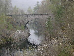
The river is crossed by several bridges:
- Fasnakyle Bridge, unclassified road
- Comar Bridge, near Cannich, carries the A831
- Mauld Bridge, near Struy, unclassified road
References
| ("Wikimedia Commons" has material about River Glass, Inverness-shire) |
- Location map: 57°25’16"N, 4°39’12"W
This Inverness-shire article is a stub: help to improve Wikishire by building it up.

