Penmark
| Penmark | |
| Glamorgan | |
|---|---|

| |
| Location | |
| Location: | 51°25’0"N, 3°21’0"W |
| Data | |
| Post town: | Barry |
| Postcode: | CF62 |
| Dialling code: | 01446 |
| Local Government | |
| Council: | Vale of Glamorgan |
| Parliamentary constituency: |
Vale of Glamorgan |
Penmark is a rural village and parish near Rhoose south-west of Barry in Glamorgan. The parish church is situated along the main road running through the village. Penmark is located near to Cardiff Airport.
Penmark Castle
The village has the remains of a 13th-century castle. Overlooking the 150-ft deep ravine of the River Waycock north of the local church are the remains of a 13th-century wall three feet thick around a court 210 ft long by 155 ft wide with a more thinly walled 16th-century outer court to the west. The moat has been filled in but there are extensive footings on the east side of the court and on the west side are overgrown ruins of a tower 23 ft in diameter with a rectangular latrine turret to the south and various other structures. Gilbert de Umfraville had a timber motte and bailey castle on this site in the 12th century. In the time of Edward II Oliver de St John obtained the castle when he married Elizabeth Umfraville, the young heiress.[1]
Gallery
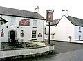
Six Bells Pub
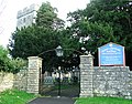
Penmark Church
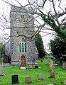
Penmark Church


References
- ↑ Joanna Billing (2003). The Hidden Places Of Wales. Travel Publishing Ltd. ISBN 190443407X. http://books.google.com/books?vid=ISBN190443407X&id=o8NCt_7hltwC&pg=RA30-PA16&lpg=RA30-PA16&ots=u64EMpsHFp&dq=Penmark+wales&ie=ISO-8859-1&output=html&sig=kgC0qmfnF-c_XjLCYeIMeZwVgqk.
Outside links
| ("Wikimedia Commons" has material about Penmark) |