Difference between revisions of "Nenthall"
From Wikishire
(Created page with "{{Infobox town |name=Nenthall |county=Cumberland |picture=Grassfield Farm Nenthall Cumbria - geograph.org.uk - 77259.jpg |picture caption=Grassfield Farm, Nenthall |os grid re...") |
(No difference)
|
Latest revision as of 17:28, 1 August 2017
| Nenthall | |
| Cumberland | |
|---|---|
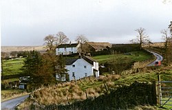
 Grassfield Farm, Nenthall | |
| Location | |
| Grid reference: | NY763463 |
| Location: | 54°48’42"N, 2°22’9"W |
| Data | |
| Local Government | |
Nenthall is a hamlet in the far east of Cumberland, beside the River Nent, downstream of Nenthead, on the A689 road which leads down the dale to Alston.
The Nent is bridged here.