Llanynys
From Wikishire
Revision as of 10:13, 10 November 2014 by Owain (Talk | contribs) (Created page with "{{Infobox town |name=Llanynys |county=Denbighshire |picture=Llanynys Church - geograph.org.uk - 136224.jpg |picture caption=St Saeran church |os grid ref=SJ1062 |latitude=53.1...")
| Llanynys | |
| Denbighshire | |
|---|---|
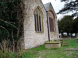
 St Saeran church | |
| Location | |
| Grid reference: | SJ1062 |
| Location: | 53°9’14"N, 3°20’38"W |
| Data | |
| Population: | 784 |
| Post town: | Ruthin |
| Postcode: | LL15 |
| Dialling code: | 01824 |
| Local Government | |
| Council: | Denbighshire |
| Parliamentary constituency: |
Clwyd West |
Llanynys is a hamlet and parish in Denbighshire, situated in the Vale of Clwyd, a few miles north of Ruthin. According to the 2001 census it has a population of 784.[1] The local church, St. Saeran, was built in the 13th Century on the site of a 6th Century monastery; Saeran was a Celtic bishop-saint. It is situated on a small rise between the winding Clwyd and Clywedog rivers, hence the name "ynys" (island).