King's Forest of Geltsdale
From Wikishire
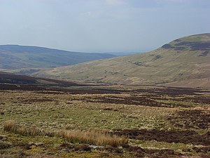
The King's Forest of Geltsdale extends over the fells at the edge of the northern Pennines in north-eastern Cumberland, through which cuts Geltsdale, the valley of the River Gelt. It is a treeless forest; a forest in the ancient sense of an expanse of open land.
The forest includes such fells as Cumrew Fell (1,600 feet) west of Geltsdale, and Cold Fell (2,037 feet) with its subsidiary top Tarnmonath Fell (1702 feet), and Crookburn Pike (1,720 feet) in the south of the forest. It extends eastward to the border with Northumberland.
Outside links
| ("Wikimedia Commons" has material about Geltsdale) |
- Location map: 54°52’12"N, 2°37’48"W
- The King's Forest of Geltsdale – walking guides by Mark Richards
- Viewranger: The King's Forest of Geltsdale

