Difference between revisions of "Innerdouny Hill"
From Wikishire
(Created page with '{{Infobox hill |name=Innerdouny Hill |county=Kinross-shire |range=Ochil Hills |picture=Trig point S6179 Innerdouny Hill - geograph.org.uk - 286743.jpg |picture caption=Trig point…') |
m |
||
| Line 13: | Line 13: | ||
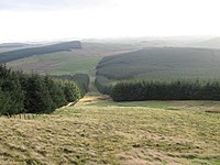
[[File:Innerdouny hillside firebreak towards Warroch Hill - geograph.org.uk - 286746.jpg|left|200px|Firebreak in the forest]] | [[File:Innerdouny hillside firebreak towards Warroch Hill - geograph.org.uk - 286746.jpg|left|200px|Firebreak in the forest]] | ||
| − | {{stub | + | {{stub}} |
[[Category:County tops]] | [[Category:County tops]] | ||
Revision as of 22:01, 14 April 2012
| Innerdouny Hill | |||
| Kinross-shire | |||
|---|---|---|---|
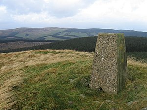
 Trig point on Innerdouny Hill | |||
| Range: | Ochil Hills | ||
| Summit: | 1,631 NO032073 | ||
Innerdouny Hill in the Ochil Hills is the highest hill in Kinross-shire, reaching 1,631. Its slopes are forested, the whole within the great Dunning.
The hill rises to its highest to the east of the north-south road between Dunning and Yetts o' Muckhart
This Mountain or hill article is a stub: help to improve Wikishire by building it up.
