Difference between revisions of "Hamps Way"
From Wikishire
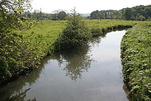
(Created page with "The River Hamps near Winkhill {{county|Staffordshire}} '''The Hamps Way''' is a walking rou...") |
|||
| Line 6: | Line 6: | ||
==Outside links== | ==Outside links== | ||
| − | *[https://ldwa.org.uk/ldp/members/show_path.php?menu_type=S&path_name=Hamps+Way Hamps Way]: Long-distance Walkers Association | + | *[https://ldwa.org.uk/ldp/members/show_path.php?menu_type=S&path_name=Hamps+Way Hamps Way]: Long-distance Walkers Association |
[[Category:Footpaths in Staffordshire]] | [[Category:Footpaths in Staffordshire]] | ||
Latest revision as of 22:58, 28 July 2021
The Hamps Way is a walking route of 14 miles along the River Hamps in the north-east of Staffordshire.
The path runs the whole length of the river, beginning at the Mermaid Inn (SK03775997) alone on the moor near the source of the river, down to Weag's Bridge (SK100542) on the River Manifold, immediately north of the meeting of the Hamps with the Manifold near Beeston Tor. The path following the river along its valley through Onecote, Winkhill and Waterhouses.
Outside links
- Hamps Way: Long-distance Walkers Association
