Dungeon Hill, Kirkcudbrightshire
From Wikishire
Revision as of 13:11, 8 June 2020 by RB (Talk | contribs) (Created page with "{{Infobox hill |name=Dungeon Hill |county=Kirkcudbrightshire |range=Galloway Hills |picture=Dungeon Hill cairn - geograph.org.uk - 144558.jpg |picture caption= |os grid ref=NX...")
| Dungeon Hill | |||
| Kirkcudbrightshire | |||
|---|---|---|---|

| |||
| Range: | Galloway Hills | ||
| Summit: | 2,001 feet NX460850 55°8’9"N, 4°25’0"W | ||
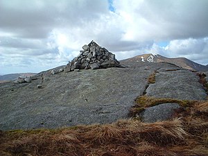
Dungeon Hill is a craggy peak in Kirkcudbrightshire reaching 2,001 feet, in the Galloway Hills two miles east of the summit of Merrick, the county top.
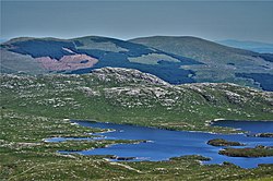
The hill is part of a longer ridge running south to north. It has tarns on its western and eastern flanks: on its west side is Loch Enoch and to the east along the Brishie Burn are two tarns: 'Long Loch of the Dungeon' and 'Found Loch of the Dungeon' and north of them the self-contradictory 'Dry Loch'.
Outside links
| ("Wikimedia Commons" has material about Dungeon Hill, Kirkcudbrightshire) |
