DuBois Island
| DuBois Island | |
| Location | |
| Location: | 66°15’58"S, 67°9’58"W |
| Data | |
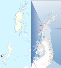
DuBois Island is one of the Biscoe Islands, which lie off the coast of Graham Land in the British Antarctic Territory. It is in the south-west of the group, to the west of Krogh Island, near the south end of the chain, and separated from Krogh Island on the east by a straight half a mile wide.
The island was photographed from the air by the Falkland Islands and Dependencies Aerial Survey Expedition, 1956-57. It was named in association with the names of pioneers in cold climate physiology grouped in this area, in this case after Eugene Floyd DuBois (1882-1959), an American physiologist who specialized in the measurement of basic metabolism and studies of the regulation of body temperature in man; Professor of Medicine, 1930-41, and of Physiology, 1941-50, Cornell University.
Outside links
- Gazetteer and Map of The British Antarctic Territory: DuBois Island
