Difference between revisions of "Cushat Law"
From Wikishire
(Created page with "{{Infobox hill |name=Cushat Law |county=Northumberland |range=Cheviot Hills |picture=Cushat Law - geograph.org.uk - 394648.jpg |picture caption=The summit cairn of Cushat Law ...") |
m |
||
| Line 15: | Line 15: | ||
The summit of Cushat Law is marked with a shelter-cairn. | The summit of Cushat Law is marked with a shelter-cairn. | ||
| + | |||
| + | ==Outside links== | ||
| + | *[http://www.cheviotwalks.org/art3.html Cheviot Walks - Cushat Law and Bloodybush Edge] | ||
Latest revision as of 16:12, 31 August 2015
| Cushat Law | |||
| Northumberland | |||
|---|---|---|---|
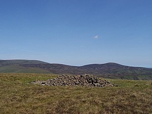
 The summit cairn of Cushat Law | |||
| Range: | Cheviot Hills | ||
| Summit: | 2,018 feet NT927137 55°25’0"N, 2°6’50"W | ||
Cushat Law is a hill amongst the Cheviot Hills, in Northumberland. It rises on the south side of the Breamish Valley, to the southwest of a lower but more dramatic hill, Shill Moor and east of a comparable fell, Bloodybush Edge, from which it is separated by a muddy col.
The Kidland Forest spreads over the southern slopes of the hill and beyond to the south.
The summit of Cushat Law is marked with a shelter-cairn.