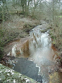
Carwinley
From Wikishire
Revision as of 12:52, 30 June 2017 by RB (Talk | contribs) (Created page with "{{Infobox town |name=Carwinley |county=Cumberland |picture=Carwinley Burn - geograph.org.uk - 322420.jpg |picture caption=Carwinley Burn |os grid ref=NY404727 |latitude=5...")
| Carwinley | |
| Cumberland | |
|---|---|
 Carwinley Burn | |
| Location | |
| Grid reference: | NY404727 |
| Location: | 55°2’46"N, 2°55’55"W |
| Data | |
| Post town: | Carlisle |
| Postcode: | CA6 |
| Dialling code: | 01228 |
| Local Government | |
| Council: | Cumberland |
| Parliamentary constituency: |
Penrith and The Border |
Carwinley is a hamlet in the very north of Cumberland, on a minor stream, the Back Burn, just a few hundred yards above the River Esk. Less than a mile upstream from the point that the burn meets the Esk, the river becomes the boundary of Cumberland with Dumfriesshire.
The first record of the village is in 1202 as Karwindelhov.[1]
| ("Wikimedia Commons" has material about Carwinley) |
References
- ↑ Koch, John T. (1997). The Gododdin of Aneirin: text and context from Dark-Age North Britain. University of Wales Press. ISBN 978-0-7083-1374-9. https://books.google.com/books?id=IIxiAAAAMAAJ. Retrieved 19 July 2012.