Arlebrook
From Wikishire
Revision as of 17:59, 8 January 2020 by RB (Talk | contribs) (Created page with "{{Infobox town |name=Arlebrook |county=Gloucestershire |picture=Farmland below Standish Woods - geograph.org.uk - 147614.jpg |picture caption=Farmland near Arlebrook |os grid...")
| Arlebrook | |
| Gloucestershire | |
|---|---|
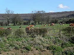
 Farmland near Arlebrook | |
| Location | |
| Grid reference: | SO812080 |
| Location: | 51°46’14"N, 2°16’22"W |
| Data | |
| Postcode: | GL10 |
| Local Government | |
Arlebrook is a hamlet in Gloucestershire, at the edge of the Cotswolds and the Vale of Berkeley, which spreads out to the west towards the River Severn. Arlebrook is two and a half miles north-west of Stroud town centre.
Two noted, listed buildings are:
- A timber framed house known as ‘the Thatched Cottage’, which was built in the 16th century.[1]
- Next to it, an 18th century sheep wash.[2]
References
- ↑ National Heritage List 1387171: Thatched House
- ↑ National Heritage List 1387172: Sheepwash immediately West of Thatched Cottage