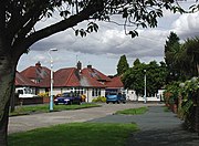
Willerby, Yorkshire
| Willerby | |
| Yorkshire East Riding | |
|---|---|
 Willerby Roundabout | |
| Location | |
| Grid reference: | TA024304 |
| Location: | 53°45’48"N, 0°27’2"W |
| Data | |
| Population: | 7,940 (2011) |
| Post town: | Hull |
| Postcode: | HU10 |
| Dialling code: | 01482 |
| Local Government | |
| Council: | East Riding of Yorkshire |
| Parliamentary constituency: |
Haltemprice and Howden |
Willerby is a village on the western outskirts of the city of Kingston upon Hull in the East Riding of Yorkshire.
Willerby was a minor settlement up to the 20th century, during which it became a suburb of Kingston upon Hull, and its urban development extended south-eastwards towards Hull. The village centre is located about five miles west of Hull city centre.
History
Until the 20th century Willerby was a small village.[1]
Enclosure of land around Willerby was enabled by acts of parliament in 1796 and 1824.[2] In 1844 the population of the 820-acre township of Willerby was 214, in 45 houses.[3]
By the 1850s Willerby had a primitive methodist chapel (built 1850),[4] a Hall, Oak Hill House, dating from the late 17th or early 18th century, now known as Willerby Hall,[1] and another large dwelling, the Summer House, later known as The Beeches dating to the 18th century, and extended in the 1820s and 1850s.[5] as well as smaller dwellings along Main Street, the village's original main road.
A mental asylum, Hull Borough Lunatic Asylum, later known as De la Pole Hospital, and an associated chapel, was constructed beyond the village to the north in the 1880s.[1] Willerby and Kirk Ella railway station opened in 1885 as part of the Hull and Barnsley Railway which passed the main village close by on the southern edge.[6]
By 1890 two further substantial houses had been built; Manor House (later Willerby Manor), and the Grange, north of the village. A new Methodist chapel and schoolroom were constructed between 1897 and 1900.[1]
Small scale growth of housing started in the 20th century, with suburban developments eastward towards Hull along Kingston Road and Carr Lane well developed by the mid 20th century.
The beehive manufacturing company Yorkshire Apiary Company based in Willerby was commissioned to produce temporary buildings after the Second World War;[7] the company, Willerby Caravan Company Ltd., (founded 1944, since 1996 Willerby Holiday Homes) was located on Main Street, the company later relocated to Hedon Road, Kingston upon Hull.[8][9][10]
In 1959 Willerby and Kirk Ella station closed,[6] the line closed completely in 1964, and the station was demolished in 1968, and the site used for a housing development.[11]
A third Methodist chapel, and the Anglican church of St Luke, were built in the late 1960s.[1]
By the late 1960s urban development grew west of the traditional village centre, in the land between Carr Lane and the Hull and Barnsley railway line, leaving the village an effective suburb of Hull, separated by the green space of Springhead Golf Course. Further development of housing estates took place in the latter part of the 20th century, north of Carr Lane.
Pictures
| ("Wikimedia Commons" has material about Willerby, Yorkshire) |
Outside links
References
- ↑ Jump up to: 1.0 1.1 1.2 1.3 1.4 Nikolaus Pevsner: The Buildings of England: Yorkshire: York & East Riding, 1972; 1995 Penguin Books ISBN 978-0-300-09593-7
- ↑ Woolley, William, ed (1830). "Chronological Table". A collection of statutes relating to the town of Kingston-upon-Hull, the county of the same town and the parish of Sculcoates. Simpkin and Marshall. pp. xi–xxviii. https://books.google.com/books?id=zMgHAAAAQAAJ&pg=PR23.
- ↑ Clarke, Benjamin (1852). "Willerby, East Riding, York". The British Gazetteer, Political, Commercial, Ecclesiastical, and Historical. 3 (L–Z). H.G. Collins. https://books.google.com/books?id=V84HAAAAQAAJ&pg=PA967.
- ↑ Wolfe, John, ed (2000). "Sculcoates District : Willerby". Yorkshire Returns of the 1851 Census of Religious Worship. Volume 1: Introduction, City of York and East Riding. Borthwick Publications, Borthwick Institute of Historical Research, University of York. p. 58. ISBN 0-903857-95-2. https://books.google.com/books?id=Yv7HRyjJn8gC&pg=PA58.
- ↑ National Heritage List 1103365: The Beeches (Grade @ listing)
- ↑ Jump up to: 6.0 6.1 Butt, R. V. J. (1995). The Directory of Railway Stations: details every public and private passenger station, halt, platform and stopping place, past and present (1st ed.). Sparkford: Patrick Stephens Ltd. ISBN 978-1-85260-508-7. OCLC 60251199.
- ↑ Graham, James (28 August 2001). "Caravans – the bee's knees as far as Hull is concerned". Yorkshire Evening Post. http://www.yorkshireeveningpost.co.uk/news/business-news/business-headlines/caravans_the_bee_s_knees_as_far_as_hull_is_concerned_1_2058225.
- ↑ Jenkinson, Andrew (2003). Caravans: The Illustrated History 1919–1959. Veloce Publishing. p. 65. ISBN 9781903706824. https://books.google.com/books?id=Yfm7Z9HTTWoC.
- ↑ Kelly's manufacturers and merchants directory, including industrial services, Volume 1. 82. Kelly's Directories Ltd. 1968. "Willerby Caravan Co. Ltd.", p.2330.
- ↑ "Company History". Willerby Holiday Homes. http://www.willerby.com/companyhistory.php.
- ↑ Willerby & Kirk Ella: Disused Stations; Subterranea Britannica


