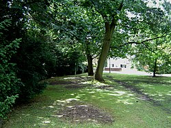
The Rythe


The Rythe is a river in Surrey which becomes a minor tributary of the River Thames, which it joins at Thames Ditton on the reach above Teddington Lock.
The Rythe rises in the vicinity of Prince's Coverts woodland near Oxshott and runs under the A3 road into Arbrook Common. It is joined by another stream and runs through Claygate[1] and Littleworth Common to the Scilly Isles roundabout at Esher. The river then follows the Portsmouth Road towards Thames Ditton, and runs into the River Thames near Ferry Road, forming the boundary between Kingston and Thames Ditton. [2]
The Rythe is an important drainage channel and has been implicated in issues of flooding in Claygate. A major flood alleviation scheme was initiated in 2002.[3]
Outside links
| ("Wikimedia Commons" has material about The Rythe) |
