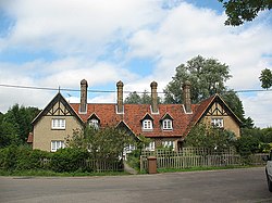
Eastwick, Hertfordshire
| Eastwick | |
| Hertfordshire | |
|---|---|
 Victorian almshouses, Eastwick | |
| Location | |
| Grid reference: | TL435118 |
| Location: | 51°47’11"N, -0°4’48"E |
| Data | |
| Postcode: | CM20 |
| Local Government | |
Eastwick is a small village immediately north of Harlow, which has so far escaped the grip of the latter. The A414 dual carriageway now separates Eastwick from its natural run down to the River Stort to the south.

This Hertfordshire article is a stub: help to improve Wikishire by building it up.