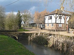
Astrope
From Wikishire
Revision as of 22:37, 5 June 2012 by RB (Talk | contribs) (Created page with '{{Infobox town |name=Astrope |county=Hertfordshire |picture=Astrope Farm - geograph.org.uk - 130337.jpg |picture caption=Astrope Farm |os grid ref=SP892150 |latitude=51.8245 |lo…')
| Astrope | |
| Hertfordshire | |
|---|---|
 Astrope Farm | |
| Location | |
| Grid reference: | SP892150 |
| Location: | 51°49’28"N, 0°41’59"W |
| Data | |
| Post town: | Tring |
| Postcode: | HP23 |
| Local Government | |
Astrope is a village in Hertfordshire.
Outside links
| ("Wikimedia Commons" has material about Astrope) |