Barling
| Barling | |
| Essex | |
|---|---|
 Boats moored in the creek near Barling Hall | |
| Location | |
| Grid reference: | TQ930895 |
| Location: | 51°34’20"N, 0°47’6"E |
| Data | |
| Population: | 1,740 (2011) |
| Post town: | Southend-On-Sea |
| Postcode: | SS3 |
| Dialling code: | 01702 |
| Local Government | |
| Council: | Rochford |
| Parliamentary constituency: |
Rochford and Southend East |
Barling is a village in eastern Essex, four miles north-east of Southend-on-Sea and 18 miles south-east of the county town, Chelmsford.
The origin of the name "Barling" is uncertain: some think it is from the Old English bar, meaning 'boar', or gebur meaning 'farm'.
Barling is by Barlinghall Creek, a tributary of the River Roach. In its agricultural setting, Barling village is mainly situated along Little Wakering Road, Church Road and Barling Road. Where these roads meet is the village duck pond.
Little Wakering
In the adjoining village of Little Wakering stands a terrace of 17th-century dormer cottages. Opposite is St Mary's Church, dating from the 11th century, but largely rebuilt by John Wakering, Bishop of Norwich from 1415-1425. In the tower are displayed the Royal Arms of George III.
Gallery
| ("Wikimedia Commons" has material about Barling) |
-
The battered old village sign of Barling.
-
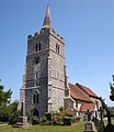
All Saints' Church, Barling
-
St Mary's Church, Little Wakering


