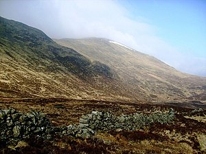
Kirriereoch Hill
| Kirriereoch Hill | |||
| Ayrshire, Kirkcudbrightshire | |||
|---|---|---|---|
 Kirriereoch Hill from Rig of Munshalloch | |||
| Range: | Range of the Awful Hand | ||
| Summit: | 2,579 feet NX420870 55°9’7"N, 4°28’47"W | ||
Kirriereoch Hill is a hill in the Range of the Awful Hand in the Southern Uplands. It stands on the border of the counties of Ayr and Kirkcudbright. The summit itself is in Kirkcudbrighshire but a few yards north, the shoulder of the hill is Ayrshire's highest point. Kirkcudbrightshire's own highest point is close by.
Kirriereoch Hill is sandwiched between the Merrick (Kirkcudbrightshire's county top), and Shalloch on Minnoch. It is within the Galloway Forest Country Park and the approaches to the mountain from the west are heavily afforested.
Ascent
The mountain is usually climbed as part of a traverse of the Range of the Awful Hand, which is a classic long hillwalk.
The traverse may begin deep on the forest track to Glen Trool Lodge, above Glen Trool, at the foot of the Merrick (where there is a car park). From there strike north through the forest towards the Merrick, down a col and up along the Neive of the Spit to the summit of the Merrick. From there, Kirriereoch Hill lies about a mile and a half beyond, northwards.
The traverse can be completed northwards into Ayrshire, down and along the top of the Carmaddie Brae to Tarfessock then north again to Shalloch on Minnoch. North-westwards is the summit of Shalloch, below which is the road. North-east though the track descends to fair lochs in the forest, though it is further to a road.