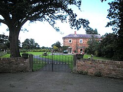
Haughton, Montgomeryshire
| Haughton | |
| Montgomeryshire | |
|---|---|
 Haughton Hall Farm, Haughton | |
| Location | |
| Grid reference: | SJ305185 |
| Location: | 52°45’35"N, 3°1’53"W |
| Data | |
| Postcode: | SY22 |
| Local Government | |
| Council: | Powys |
Haughton is a small village in Montgomeryshire, in a loop of the River Vyrnwy, just above where the river joins the River Severn. The Vyrnwy here marks the border of Montgomeryshire with Shropshire to the east.
The village is east of Offa's Dyke. Traces of which are found two miles to the west.