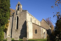
Sutton, Northamptonshire
| Sutton | |
| Northamptonshire | |
|---|---|
 St Michael, Sutton | |
| Location | |
| Grid reference: | TL096987 |
| Location: | 52°34’31"N, 0°22’58"W |
| Data | |
| Population: | 196 (2011) |
| Post town: | Peterborough |
| Postcode: | PE5 |
| Dialling code: | 01780 |
| Local Government | |
| Council: | Peterborough |
| Parliamentary constituency: |
North West Cambridgeshire |
Sutton is a small village in the Soke of Peterborough, in the north-east of Northamptonshire, about six miles from Peterborough and approximately half a mile south of the A47 road.
The village is beside a loop the River Nene, which forms the county's border with Huntingdonshire: across the river stands Stibbington.
History
Dating all the way back to 972–992, the area of Peterborough was described as a "woody swamp" but was cleared to a certain degree when Abbot Adulf built manor houses and granges.[1] In 'Old English', Sutton translates as a Southern farm/settlement.
The ancient church of Sutton dates back to the 12th century and was originally built as a chapel-of-ease to the church of St Kyneburgha in Castor. It is also home to a war memorial.[2] The church, now named St Michael & All Angels, was originally dedicated to St Giles, the patron saint of cripples, lepers and nursing mothers. The majority of the church was rebuilt in 1867–8, but the arch supports have survived from the original construction in the 12th/13th century.[3]
The historical layout of the village is a simple rectangle of streets engulfing a green where cattle would be, known as a Saxon nucleated settlement (or a nucleated village), with the grange and chapel located in one corner of the rectangle. With the village being in close proximity to the River Nene, there was once a ford going over to Stibbington, but this was eventually destroyed by dredging after a long period of not being used.
The Manor Farm (also known as 'The Grange') was built in the 17th century. Keith Garrett described the manor as a "fully constituted manor with its manor house or hall, its home farm, open fields, and lands of villeins, who held their dwellings and small agricultural holdings for customary services in cultivating the Abbey's home farm etc."[4]
In 1870–72, this is how John Marius Wilson's Imperial Gazetteer of England and Wales described Sutton:
SUTTON, a chapelry in Castor parish, Northampton; on the river Nen, near Wansford r. station. Acres, 880. Real property, £1,101. Pop., 112. Houses, 22. The living is a p. curacy in the diocese of Peterborough. Value, not reported. Patron, the Bishop of P. The church is ancient. Charities, £10.[5]
Picture
| ("Wikimedia Commons" has material about Sutton, Northamptonshire) |
References
- ↑ Garrett, Keith. "Sutton Manor History". http://www.thearchive.org.uk/history/h1047.htm.
- ↑ "List of Memorials". http://www.roll-of-honour.com/Memorials/allmemorials.html.
- ↑ Cambridgeshire Federation of Women's Institutes. The Cambridgeshire Village Book. Countryside Books. http://www.visitoruk.com/Peterborough/sutton-C592-V28855.html. Retrieved 21 April 2015.
- ↑ Garrett, Keith. "Sutton Manor History". http://www.thearchive.org.uk/history/h1047.htm.
- ↑ Wilson, John Marius (1872). Imperial Gazetteer of England and Wales. Edinburgh. http://www.visionofbritain.org.uk/place/8193. Retrieved 21 April 2015.


