Cold Higham
| Cold Higham | |
| Northamptonshire | |
|---|---|
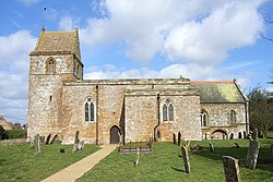
 St Luke's, Cold Higham | |
| Location | |
| Grid reference: | SP662535 |
| Location: | 52°10’34"N, 1°1’57"W |
| Data | |
| Population: | 290 (2011) |
| Post town: | Towcester |
| Postcode: | NN12 |
| Dialling code: | 01327 |
| Local Government | |
| Council: | West Northamptonshire |
| Parliamentary constituency: |
South Northamptonshire |
Cold Higham is a village in Northamptonshire, The wider civil parish also includes such hamelts as Fosters Booth (to the west), Grimscote, and Potcote. It is adjacent to Weedon Bec, Pattishall, Eastcote and Astcote. The A5 runs along the eastern boundary of the parish, along the route of Watling Street, a Roman road.
The parish had a population of 290 at the time of the 2011 Census.
Names
The village's name means 'High homestead/village' or 'high hemmed-in land'. 'Cold' for its exposed situation.[1]
The village of Grimscote, which is in this parish, means "Grim's Cott", Grim being another name for Woden.[2]
Outside links
| ("Wikimedia Commons" has material about Cold Higham) |
References
- ↑ "Cold Higham". The University of Nottingham. http://kepn.nottingham.ac.uk/map/place/Northamptonshire/Cold%20Higham. Retrieved 2022-01-02.
- ↑ Gelling, Margaret (1988). Signposts To The Past: Place-Names and The History of England. Phillimore. p. 149. ISBN 0-85033-649-X.
