Quina Brook
| Quina Brook | |
| Shropshire | |
|---|---|
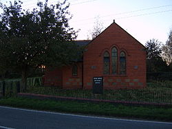
 Methodist chapel in Quina Brook | |
| Location | |
| Grid reference: | SJ524329 |
| Location: | 52°53’28"N, 2°42’32"W |
| Data | |
| Post town: | Shrewsbury |
| Postcode: | SY4 |
| Dialling code: | 01939 |
| Local Government | |
| Council: | Shropshire |
| Parliamentary constituency: |
North Shropshire |
Quina Brook is a hamlet in northern Shropshire, near the border with Flintshire. Population details for the 2011 census are found under Wem Rural.
Quina Brook was the final destination of an arm of the Ellesmere Canal. This arm was originally going to terminate at Prees. The arm is now known as the Press Branch of the Llangollen Canal, and is navigavable for about a mile to Whixall Marina, the following ¾ mile is still followable on the towpath as it passes through Prees Branch Canal Nature Reserve.[1]
References

This Shropshire article is a stub: help to improve Wikishire by building it up.