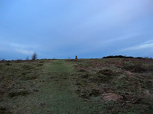
Wolstonbury Hill
| Wolstonbury Hill | |||
| Sussex | |||
|---|---|---|---|

| |||
| Range: | South Downs | ||
| Summit: | 676 feet TQ28401382 50°54’35"N, 0°10’30"W | ||
Wolstonbury Hill is a distinctive hill of 676 feet amongst the the South Downs in Sussex. It forms a northern projection of the scarp of the Downs, north of Pyecombe. Below its own northern escarpment, the lower middle parts of the county begin: Hurstpierpoint is to the north, in a string of villages. On the summit is a Bronze Age hill fort; Wolstonbury Camp, which is a Scheduled Ancient Monument.[1]
The hill is owned by the National Trust,[2] as part of a wider estate on this part of the Downs.
Of this hill, 146 acres have been designated a biological Site of Special Scientific Interest.[3]
Description
Wolstonbury projects towards the Weald from the main ridge of the South Downs giving views of both the Downs and the Weald. Views across the Weald to the north are panoramic, to the east are the Clayton Windmills and Ditchling Beacon beyond. Hollingbury is prominent to the south-east. Looking west one can see Newtimber Hill, West Hill with Devils Dyke just beyond, further out Chanctonbury Ring is clearly visible.
Wolstonbury, owned and maintained by the National Trust.
Geology
South of Hurstpierpoint ridge, the clay vale lies beneath the jutting profile and complex scarp and foot of Wolstonbury Hill.
The approach from the north is characterised by a network of linked or closely spaced woodlands (some parts ancient) centred on the designed landscape at Danny House.
Archaeology and history
The remains at the hill fort site include a five and a half acre early Bronze Age enclosure now referred to as 'Wolstonbury C'.[4] A possible inner enclosure known as 'Wolstonbury A' appears to be older, due to it being overlain by C. 'Wolstonbury B' is another possible enclosure sandwiched between A and C, its presence indicated by a survey conducted in 1994 by the Royal Commission on the Historical Monuments of England. Excavations done by Bournemouth University in 1995 suggest that Wolstonbury A and B may be field lynchets.[5]
Skeletons were reportedly unearthed during flint digging operations begun in 1765. This digging continued until the mid-19th century, resulting in extensive damage to the site. Unknown quantities of Neolithic and early Bronze Age flintwork were discovered in a 1929 dig as well as "Romano-British" pottery, animal bones, and hammerstones.[6]
Outside links
| ("Wikimedia Commons" has material about Wolstonbury Hill) |
- wolstonbury.com
- Saddlescombe Farm and Newtimber Hill: Wolstonbury Hill – National Trust
References
- ↑ National Heritage List 1016153: Wolstonbury Camp (Scheduled ancient monument entry)
- ↑ Wolstonbury Hill: National Trust
- ↑ SSSI listing and designation for Wolstonbury Hill
- ↑ "Introduction to Wolstonbury". https://csweb.bournemouth.ac.uk/wolstonbury/wol_intro.html.
- ↑ "Research by Bournemouth University – Wolstonbury Prehistoric Enclosures". https://csweb.bournemouth.ac.uk/wolstonbury/wol_bmth_res.html.
- ↑ "Summary of Archaeological History – Wolstonbury". https://csweb.bournemouth.ac.uk/wolstonbury/wol_summary.html.
