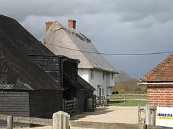
Iden, Sussex
| Iden | |
| Sussex | |
|---|---|

| |
| Location | |
| Grid reference: | TQ918238 |
| Location: | 50°58’48"N, 0°43’48"E |
| Data | |
| Population: | 456 (2011, parish) |
| Post town: | Rye |
| Postcode: | TN31 |
| Dialling code: | 01797 |
| Local Government | |
| Council: | Rother |
| Parliamentary constituency: |
Hastings and Rye |
Iden is a village in Sussex, two miles north of Rye.
The parish church, All Saints, are of the 12th or 13th century
Iden is listed in the Domesday Book.
Outside links
| ("Wikimedia Commons" has material about Iden, Sussex) |
References
This Sussex article is a stub: help to improve Wikishire by building it up.