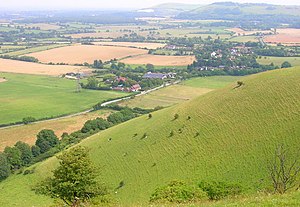
Edburton Hill
| Edburton Hill | |||
| Sussex | |||
|---|---|---|---|
 The scarp of Edburton Hill | |||
| Range: | South Downs | ||
| Summit: | 623 feet TQ23691093 50°53’5"N, 0°14’35"W | ||
Edburton Hill is a hill on the northern edge of the South Downs, and part of that stretch known as the 'Beeding Hill to Newtimber Hill Escarpment' (which is designated a 'Site of Special Scientific Interest'.
On a spur of the hill are the earthworks of a small Norman motte and bailey castle, known as the [Edburton Castle Rings]]. The castle was built soon after the Conquest, perhaps on the site of much older earthworks. It is believed that the castle was a timber construction and occupied only briefly. Later, in 1260, the Lord of Perching received a licence to build a fortified manor house down under the hill. The banks of the Motte and Bailey have field fleawort, and one may find some patches of chalk milkwort which is much more sky-blue than common milkwort, and almost unknown to the west of Brighton.
There was a scatter of Bronze Age round barrows along this scarp top, but only one is now in good condition — on the South Downs Way just east of the cross roads in the dip between Truleigh and Edburton Hills.[1] In spring the slopes are whitey-green with the new leaves of whitebeam, and there are many cowslips. Some years there are green hairsteak and brimstone butterflies. The east of the Hill is Fulking Hill, in Fulking parish.