Coldwaltham
| Coldwaltham | |
| Sussex | |
|---|---|
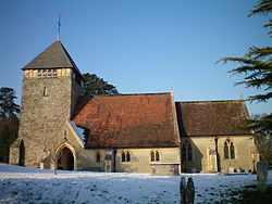
 St Giles Church | |
| Location | |
| Grid reference: | TQ024165 |
| Location: | 50°56’21"N, -0°32’38"W |
| Data | |
| Population: | 845 (2011) |
| Post town: | Pulborough |
| Postcode: | RH20 |
| Dialling code: | 01798 |
| Local Government | |
| Council: | Horsham |
| Parliamentary constituency: |
Arundel and South Downs |
Coldwaltham is a village in Sussex. It is divided in two by the A29 road and stands two and a half miles south-west of Pulborough, which has a railway station on the Arun Valley Line. The 2011 Census population included the village of Hardham plus hamlet of Watersfield.
The parish church, St Giles, is of the 13th century. A rare 11th century gravestone and a simple Saxon font are found there. A yew tree near the north-west corner is among the oldest in Britain; believed to be over 3,000 years old.[1]
There is one pub, the Labouring Man. Sandham Hall is used for village events.
Outside links
| ("Wikimedia Commons" has material about Coldwaltham) |
