Redbourne
| Redbourne | |
| Lincolnshire | |
|---|---|
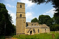
 Redbourne church | |
| Location | |
| Grid reference: | SE972001 |
| Location: | 53°29’19"N, -0°32’7"W |
| Data | |
| Population: | 400 (2011) |
| Post town: | Gainsborough |
| Postcode: | DN21 |
| Local Government | |
| Council: | North Lincolnshire |
| Parliamentary constituency: |
Scunthorpe |
Redbourne is a village and parish in the Lindsey part of Lincolnshire. The village is situated near the A15 road, five miles south from Brigg. According to the 2001 Census Redbourne had a population of 386, rising slightly to 400 at the 2011 census.[1]
The name Redbourne is derived from the Old English Name "Hredburna" meaning "reedy burn", a reference to a stream running through the village.[2]
The parish church of St Andrew was made redundant from the Church of England in 1978 and is now maintained by The Churches Conservation Trust. It is a Grade-I listed building. Although the church has 14th- and 15th-century origins, the bulk of the existing building is 18th-century and represents a Georgian Gothic style, using a mixture of squared and coursed rubble limestone with ashlar dressings. Its square tower is approximately 90 ft high. The alterations of 1772–4 in the gothic style were by the Lincoln architects Thomas and Henry Lumby and the chapel on the south side of the chancel served as a mausoleum for the family of the Dukes of St Albans.[3]
The Red Lion Hotel coaching inn on the village green dates from the 17th century.
A conservation area was designated in August 1985 which covers the historic village core but excludes the more recent residential developments on the periphery.
References
| ("Wikimedia Commons" has material about Redbourne) |
- ↑ UK Census (2011). "Local Area Report – Redbourne Parish (E04000574)". Nomis. Office for National Statistics. https://www.nomisweb.co.uk/sources/census_2011_ks/report?compare=E04000574. Retrieved 20 December 2020
- ↑ Redbourne Conservation Area Appraisal. Retrieved 1 June 2013
- ↑ Antram N (revised), Pevsner N & Harris J, (1989), The Buildings of England: Lincolnshire, Yale University Press. pg 608
