Woodham, Surrey
| Woodham | |
| Surrey | |
|---|---|
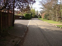
 Woodham Park Way | |
| Location | |
| Grid reference: | TQ041618 |
| Location: | 51°20’46"N, -0°30’24"W |
| Data | |
| Postcode: | KT15 |
| Local Government | |
| Council: | Runnymede |
Woodham is a suburban village in Surrey next to New Haw and contiguous with two suburbs of Woking: Sheerwater and West Byfleet.
Churches
In the Church of England Woodham is the western half of the ecclesiastical parish of New Haw, whose parish church, All Saints, stands at the west end of Woodham Lane. It was designed in the Old Surrey style by W F Unsworth, and is a Grade II listed building. A separate church hall is located beyond the car park at the rear.
The parish was formed in 1902 (from what had been part of Chertsey and then its offshoot Addlestone)[1]
A Baptist chapel was built in 1872, and a Wesleyan chapel in 1898.[2]
Sports Facilities
The well-established New Zealand Golf Club is situated parallel to Woodham Lane.
Outside links
| ("Wikimedia Commons" has material about Woodham, Surrey) |
References
- ↑ All Saints: New Haw The Church of England. Retrieved 2018-04-24
- ↑ A History of the County of Surrey - Volume 3 pp 403-413: 'Parishes: Chertsey' (Victoria County History)
