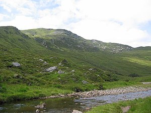
Sgùrr na Feartaig
| Sgùrr na Feartaig | |
| Ross-shire | |
|---|---|
 Sgurr na Feartaig | |
| Summit: | 2,828 feet NH05454542 57°27’26"N, 5°14’41"W |
Sgùrr na Feartaig is a mountain of 2,828 feet in the west of Ross-shire, halfway between Glen Carron to the north and Loch Monar on the border of Inverness-shire to the south-east, and between the two treeless estates of the Achnashellch Forest to the north-west and the West Monar Forest to the south-east.
The mountain stretches in a ridge form the east-north-east to the west-south-west. North of the summit peak below a steep scarp lies a tarn, Loch Sgùrr na Feartaig.
To the north-east stands Sgùrr na Ceannaichean at 2,995 feet, and to the west are twin munro peaks of the Torridon Hills, Sgurr Choinnich (3,278 feet) and Sgùrr a' Chaorachain (3,455 feet).
Outside links
| ("Wikimedia Commons" has material about Sgùrr na Feartaig) |
