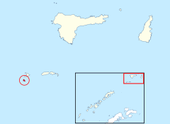
O'Brien Island
| O'Brien Island | |
| Location | |
| Location: | 61°30’25"S, 55°58’2"W |
| Highest point: | 1,772 feet |
| Data | |
O'Brien Island is a small rocky island in the South Shetland Islands in the British Antarctic Territory. It lies four nautical miles west of Gibbs Island and all to the south-west of Elephant Island in the easternmost group of South Shetland. It is in a cluster of three neighbouring island lying north to south: Aspland Island, Eadie Island and O'Brien Island. Aspland is two nautical miles to the north-east.
The island rises to 1,772 feet above the sea. A strong marine channel, named Tasman Rip, runs between O'Brien Island and Eadie Island.
The island was roughly charted by Bransfield in February-March 1820 and, together with Aspland Island and Eadie Island, named 'O'Briens Islands': a chart of 1821 applied the name 'O'Brien's Island' just to today's O'Brien Island
The island was further charted by the German Atlantic Expedition in Meteor (under Captain F. Spiess, from whom the Spiess Glacier is named) in 1926. The island was recharted by Discovery Investigations in February 1937. It was photographed from the air by the Falkland Islands and Dependencies Aerial Survey Expedition, 1956-57.
Important Bird Area
The island has been identified as an Important Bird Area by BirdLife International because there are records (from 1977) of it supporting large breeding colonies of chinstrap penguins (21,000 pairs) and southern fulmars (8000 pairs).[1]
References
- ↑ O'Brien Island IBA: BirdLife International
- Gazetteer and Map of The British Antarctic Territory: O'Brien Island
