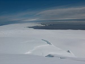
Hero Bay

Hero Bay is a bay between Cape Shirreff and Williams Point on the north coast of Livingston Island, one the South Shetland Islands in the British Antarctic Territory. The bay is 17 miles wide, indents for six miles the northern side of the island.
A number of glaciers, the Saedinenie Snowfield, Tundzha, Berkovitsa, Medven and Urdoviza feed the bay.
The bay was roughly charted by the nineteenth-century sealers between 1820-24 and at some point came to be marked as 'Blythe Bay': this though was in error as the small bay earlier given this name is on the south-east side of Desolation Island The bay recharted by Discovery Investigations 1933-1934 and again called 'Blythe Bay'. Following air photography by the Falkland Islands and Dependencies Aerial Survey Expedition and ground survey by the Falkland Islands Dependencies Survey in 1956-58, the name 'Blythe Bay' was returned to the original feature so named, and the bay on Livingston was renamed 'Hero Bay'.
The name chosen is after the American sloop Hero commanded by Captain Nathaniel Palmer, from whom the Palmer Coast, Palmer Archipelago and Palmer Land are named. The Hero was one of the ships of Pendleton's sealing fleet from Stonington, Connecticut, which sailed to the South Shetland Islands in 1820-21. The fleet made at least three circumnavigations of Livingston Island and from which Half Moon Island and Yankee Harbour were discovered.
Location
- Location map: 62°30’58"S, 60°27’58"W
References
- Gazetteer and Map of The British Antarctic Territory: Hero Bay