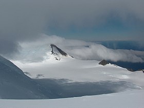
Macy Glacier

Macy Glacier is a crescent-shaped glacier three and a half miles long and a mile and a haldf wide flowing south into Brunow Bay on the south coast of Livingston Island, one of the South Shetland Islands in the British Antarctic Territory. The glacier is bounded by the ridge of Mount Friesland, the island's highest mountain, to the north-west.
The glacier was was photographed from the air by the Falkland Islands and Dependencies Aerial Survey Expedition in the 1956-57 season and surveyed from the ground by the Falkland Islands Dependencies Survey in1957-58.
It is named in association with the names of nineteenth-century sealers in this area: Macy Glacier is named after Captain Robert Macy, Master of the brig Aurora, one of the fleet of sealers from New York commanded by J. Byers (from whom the Byers Peninsula is named) which visited the South Shetland Islands in 1820-21, operating first at Rugged Island and later from Yankee Harbour on Greenwich Island.
Location
- Location map: 62°41’20"S, 60°8’5"W
References
- Gazetteer and Map of The British Antarctic Territory: Macy Glacier