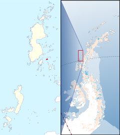
Zukriegel Island
| Zukriegel Island | |
| Location | |
| Location: | 65°53’34"S, 65°47’8"W |
| Data | |
Zukriegel Island lies to the east of Rabot Island in the Biscoe Islands, which lie off the coast of Graham Land in the British Antarctic Territory.
The island was photographed from the air in 1956 by the Argentinian Anatarctic Expedition of that year. It is named in association with the names of sea-ice specialists grouped in this area: this island is named after Josef Zukriegel, a Czechoslovakian geographer and author of Cryologia maris (1935).
