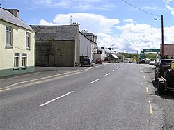
Cloghan, County Donegal
| Cloghan Irish: An Clochán | |
| County Donegal | |
|---|---|
 Cloghan | |
| Location | |
| Grid reference: | H041994 |
| Location: | 54°50’33"N, 7°56’13"W |
| Data | |
| Local Government | |
| Council: | Lifford-Stranorlar |
| Dáil constituency: |
Donegal |
Cloghan is a village located in the rural centre of County Donegal, on the R252 regional road eight miles north-west of the "Twin Towns" of Ballybofey and Stranorlar.
Cloghan has one of the most prolific wild salmon and sea trout fishing areas in Ireland. The Finn River system includes a catchment area of about 195 square miles and includes up to twenty loughs as well as the River Finn and River Reelan.
The area is also known as a hunting location and has miles of hiking trails in the Bluestack Mountains that divides County Donegal, north from south.