Meelin
| Meelin Irish: An Mhaoilinn | |
| County Cork | |
|---|---|
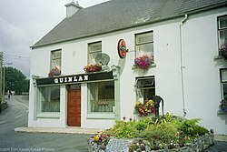
 Pub and floral display in Meelin | |
| Location | |
| Grid reference: | R295131 |
| Location: | 52°15’54"N, 9°1’55"W |
| Data | |
| Local Government | |
| Dáil constituency: |
Cork North-West |
Meelin is a village in northern County Cork, in the Barony of Duhallow, near the border with County Limerick and County Kerry. Its name is from the Irish An Mhaoilinn, meaning 'The bare, flat-topped hillock'[1]
At 823 feet above sea level, Meelin claims the title of the highest village in Ireland, although Glencullen in County Dublin also claims to be the highest at about 825 feet, and both would be considered dishonest in their claims by the Lyre, County Cork, at 875 feet.
History
Fulacht fiadhs (a form of Bronze Age burned mound) are found in Meelin and around the Duhallow area. There is also a 4,000-year-old burial mound in the village.
In the early 20th century quarries were set up in the village and employed over 100 people. But in the 1920s quarrying started to slow down and by 1964 it had stopped altogether. In 1963, the geologist William Morton carried out a survey of the limestone area around the village and assumed there might be oil deep in the rocks. After three oil companies drilled over 5,000 feet into the rocks, no oil or gas was found.
Churches
The church of St Joseph was built in 1837, Meelin is part of the Clonfert parish. In 1871 a Bell for the church was brought to the village by John Murphy. It was built over the gallery in a bell tower and remained there until 1970 when repairs were carried out on the church.
Sport
Gaelic Athletics: Meelin GAA, founded in 1928. Hurling is the predominant sport in Meelin.
References
- ↑ An Mhaoilinn/Meelin: Placenames Database of Ireland