Kealkill
| Kealkill Irish: An Chaolchoill | |
| County Cork | |
|---|---|
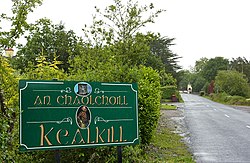
 Signage at Kealkill village | |
| Location | |
| Grid reference: | W043560 |
| Location: | 51°45’3"N, 9°22’49"W |
| Data | |
| Local Government | |
Kealkill is a small village in County Cork, six and a half miles from Bantry and 47 miles from Cork.
The village has a church, a shop, a school, a community playgroup, two public houses and a Gaelic Athletic Association club; St Colum's GAA.
History and prehistory

Kealkill Stone Circle is a very small, recumbent stone circle of just five stones with a pair of outlier standing stones, and the remains of a radial stone cairn. Breeny More Stone Circle also stands nearby, while Maughanasilly Stone Row is in the hills to the north.
Visitors to the circle can view Bantry Bay to the west, Cnoc Baoi to the north and the Sheha Hills to the east. A series of walks connect the circle to Carriganass Castle and the Sheep's Head Way.
On Wednesday 19 April 1922, the first fatalities of the Irish Civil War occurred in Kealkill when two members of the Irish Republican Army (the Anti Treaty force) army were killed; men from nearby Bantry.
References
- An Chaolchoill / Kealkill: Placenames Database of Ireland