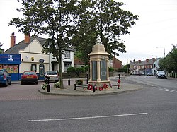
Jacksdale
| Jacksdale | |
| Nottinghamshire | |
|---|---|
 Jacksdale War Memorial | |
| Location | |
| Grid reference: | SK447516 |
| Location: | 53°3’35"N, 1°20’4"W |
| Data | |
| Population: | 3,158 (2011) |
| Post town: | Nottingham |
| Postcode: | NG16 |
| Dialling code: | 01773 |
| Local Government | |
| Council: | Ashfield |
| Parliamentary constituency: |
Ashfield |
Jacksdale is a former mining village in the north of Nottinghamshire, on the eastern bank of the infant River Erewash, which forms the Derbyshire border, such that Jacksdale is Nottinghamshire's westernmost village.
A section of the Cromford Canal loops past Jacksdale, on the Derbyshire side of the river.
The population of Jacksdale was recorded as 3,158 in the 2011 census
Neighbouring villages include Selston, Brinsley, Pye Hill and Ironville. Jacksdale and Westwood are interlinked, although houses in Westwood are usually newer, whereas 86 per cent of the housing in Jacksdale was built before 1918.
History
In 1811, Jacksdale consisted of only three farms.[1] It grew after the arrival, of the railways and became the centre for shops and amenities for the area.[2]
Jacksdale's coal mine was first sunk in 1874 by James Oakes & Co. Its entrance was sited at Selston Road at an exposed section of the Nottinghamshire coalfield. Pye Hill pit, as it was known, was actually an amalgamation of three individual pits sunk by different mining companies, Jacksdale's pit was renamed "Pye Hill No 2", No 1 being Selston/Underwood and No 3 New Selston.[3]
Pye Hill pit was closed in 1985. The spoil heaps have since been made safe and landscaped for walking, providing access to nearby Jubilee Hill. The nature reserve there demonstrates colonising vegetation and scrub.[4]
About the village
Local amenities include a post office, a supermarket, a chemist, hair salons and barbers, an estate agency and lettings agency, a hardware and motor parts outlet, a repair garage, butchers, a newsagent, a library, a Pentecostal church, a Chinese restaurant, a community centre, a fish and chip shop, dentists' and doctors' surgeries, care homes, and a garden centre.[5]
Several local community groups for adults, children and special interests are shared with Westwood.[6] The Anglican St. Mary's Church, Westwood, which also covers Jacksdale, is a daughter church of St. Helen's Church, Selston.
Outside links
| ("Wikimedia Commons" has material about Jacksdale) |
References
- ↑ Selston Parish Council
- ↑ History and heritage: Jacksdale and Westwood Community
- ↑ Fionn Taylor. "Eastwood and its Collieries". http://www.healeyhero.co.uk/rescue/eastwood.htm.
- ↑ Nature reserves: Jacksdale and Westwood Community
- ↑ Shops and businesses: Jacksdale and Westwood Community
- ↑ Jacksdale and Westwood Community & Heritage Retrieved 24 March 2016.
