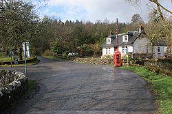
Cobleland
| Cobleland | |
| Perthshire | |
|---|---|
 Cobleland | |
| Location | |
| Grid reference: | NS531987 |
| Location: | 56°9’30"N, 4°21’59"W |
| Data | |
| Local Government | |
| Council: | Stirling |
Cobleland is a hamlet in Perthshire, on the south bank of the River Forth, on the river's upper reach.
There is little to the hamlet: a few houses and a farm and a campsite. An early nineteenth century stone bridge crosses the Forth here, the Cobleland Bridge, carrying what was once the main road from Glasgow to Aberfoyle and on to the Trossachs. A few hundred yards downstream is the A81 Forth Bridge which carries the modern road.