Bagshaw
| Bagshaw | |
| Derbyshire | |
|---|---|
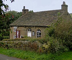
 Bagshaw Methodist Chapel | |
| Location | |
| Grid reference: | SK078811 |
| Location: | 53°19’38"N, 1°53’1"W |
| Data | |
| Postcode: | SK23 |
| Local Government | |
| Council: | High Peak |
| Parliamentary constituency: |
High Peak |
Bagshaw is a hamlet in Derbyshire, about three-quarters of a mile east of Chapel-en-le-Frith, to whose civil parish it has been allocated.
The hamlet is within the boundaries of the Peak District National Park. It stands in the valley of a small stream which flows westward towards the Black Brook. It has a small Methodist chapel.
Outside links
| ("Wikimedia Commons" has material about Bagshaw) |
