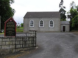
Springfield, Fermanagh
| Springfield | |
| Fermanagh | |
|---|---|
 Springfield Methodist Church | |
| Location | |
| Grid reference: | H174466 |
| Location: | 54°22’4"N, 7°43’59"W |
| Data | |
| Postcode: | BT74 |
| Dialling code: | 028 |
| Local Government | |
| Council: | Fermanagh and Omagh |
| Parliamentary constituency: |
Fermanagh and South Tyrone |
Springfield is a small village in Fermanagh, four miles west of Enniskillen along the B81 and on the rising hills looking down towards Lower Lough Erne to the north. At the 2001 Census, Springfield had a population of 69 people.
References
- Springfield - Placenames NI
This Fermanagh article is a stub: help to improve Wikishire by building it up.