North Rauceby
| North Rauceby | |
| Lincolnshire | |
|---|---|
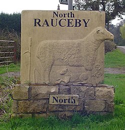
 North Rauceby village sign | |
| Location | |
| Grid reference: | TF024464 |
| Location: | 53°0’23"N, 0°28’44"W |
| Data | |
| Population: | 159 (2011) |
| Post town: | Sleaford |
| Postcode: | NG34 |
| Dialling code: | 01529 |
| Local Government | |
| Council: | North Kesteven |
| Parliamentary constituency: |
Sleaford and North Hykeham |
North Rauceby is a village in Kesteven, the south-western part of Lincolnshire. It is situated four miles north-west of Sleaford, and at the 2011 census had 159 residents.
North Rauceby is a shrunken village, being associated with a partial lost settlement.[1]
The parish church, St Peter, is on Church Lane: it serves both North and South Rauceby and is part of the group of churches that includes those of surrounding villages.
The village school is Rauceby Primary School, which also serves South Rauceby and other local villages.
Around the village
Cranwell Aviation Heritage Centre is based in North Rauceby; its site also houses a park for touring caravans.
The Rauceby Maize maze is an attraction during the summer months.
See also
Outside links
| ("Wikimedia Commons" has material about North Rauceby) |
References
- ↑ National Monuments Record: No. 348926 – Shrunken village at North Rauceby, Lincolnshire
