Corfe Mullen
| Corfe Mullen | |
| Dorset | |
|---|---|
 Wareham Road, Corfe Mullen | |
| Location | |
| Grid reference: | SY986978 |
| Location: | 50°46’12"N, 2°1’3"W |
| Data | |
| Population: | 10,133 ((2011)) |
| Post town: | Wimborne |
| Postcode: | BH21 |
| Dialling code: | 01202 |
| Local Government | |
| Council: | Dorset |
| Parliamentary constituency: |
Mid Dorset & North Poole |
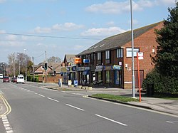
Corfe Mullen is a village in Dorset, on the north-western urban fringe of the conurbation spread out from Poole. The village had a recorded population of 10,133 in 2011.
This is a sizable place, with six churches, four pubs, five schools, a library, range of shops and local businesses, a village hall, and many community and sports organisations.
The name 'Corfe Mullen' is a mixed one, derived from the Old English 'corf' for a cutting or pass, and the Old French for a mill 'molin'.[1] The mill referred to is the old water mill mentioned in the Domesday Book, which stood on the River Stour, where the village originally stood.
Despite the proximity of the urban area, Corfe Mullen is surrounded by Green Belt. It lies within the area known as the Dorset Heaths.
History
Prehistory to the Romans
The first evidence of people living in the area consists mainly of a number of flint axeheads that have been found within the village and which date from the Palaeolithic and Mesolithic ages. Later Bronze Age burial mounds or barrows are found to the east of the village at Barrow Hill and at Naked Cross at the southern end of the village. Traces of Iron Age pottery are found too, manufactured around the 1st century BC.
In the 1st century AD, the Romans built a 40-acre fortress just to the north of the village at Lake Farm, three miles from the Iron Age Hill Fort at Badbury Rings. It was abandoned soon after as the frontier moved north.

Roman roads were built, of which one is visible today, from the deep-water anchorage at Morionio (now Hamworthy) and running northwards to Badbury and Hod Hill. Traces of two other roads have also been found, both of which are underneath or follow the course of modern roads; one of these linked Lake with Dorchester, along the present A31, and the other running through the spine of the village to Wareham.
Middle Ages
The village itself, and its name, are from the Saxon period. After the Norman Conquest, Corf's entry in the Domesday Book shows that it appears to have been a single manor under 'Robert, son of Gerold', but was previously held by two English lords; Waga and Egelric. At some time during the next two or three centuries, the village reverted to two manors; probably Corf Molin and Corf Hubert. By 1469, the two manors were combined into one again.
A third part of the village came to be known as Corfe Mullen St Nicholas, apparently since a land acquisition by St Nicholas Hospital, a Salisbury charity, in 1279. The present-day areas of Lambs Green, East End and Brog Street were still called this until the early part of the 20th century.
Construction of the original parish church, then called St Nicholas but now St Hubert's, was commenced during the 13th century, with the tower being added a little later.
Modern period

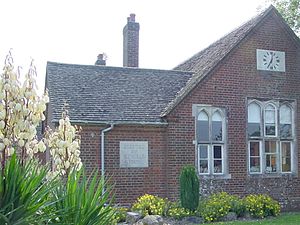
No major landowner had a country house in the village, but there is an Elizabethan manor house, known as the Court House, which was home to the Phelipps family. In 1706, Richard Lockyer founded Lockyer's Charity School in the village: the original schoolhouse is now Lockyer's Middle School.
During the latter half of the 18th century a turnpike road was constructed through the parish, as a route between Poole and Blandford. More turnpike roads were constructed in the Victorian Age. The railways arrived by the late 19th century, and though the railway passed close to Corfe Mullen, it was only in the 20th century before a that Corfe Mullen Halt was opened.
In the 20th century development accelerated. Development between the wars occurred along Higher Blandford Road and Wareham Road, with the populated area gradually extending up the hill, away from the original riverside centre at Mill Street and the older cottages at Brog Street, Lambs Green and East End. In the 1950s and 1960s major new housing estates were built around Phelipps Road and Hilltop Road, and in the last forty years of the century, new housing was built on most of the area between Broadstone and the eastern boundary of the village.
During the early part of the century, the village became known for its violet and lavender cultivation, which was centred around Violet Farm. The trade diminished however and the farm was demolished in the 1960s, along with a 300-year-old tithe barn, to make way for new bungalows.
Churches
- St Hubert's, the original parish church.
- St Nicholas, the new Anglican church.
- Corfe Mullen Baptist Church
- Sunnyhill Church Corfe Mullen
- Knoll Farm Christian Fellowship
Pubs
- The Coventry Arms
- The Dorset Soldier
- The Holme Bush
- The Lambs Green Inn
- Royal British Legion
Sport
- Corfe Mullen Sports Association, including:
- Corfe Mullen Cricket Club, based at Corfe Mullen Recreation Ground
- Football club
- Tennis club
- Baseball team.
Nature park
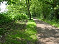
In 2016, Corfe Barrows Nature Park was opened. The nature park comprises eight natural areas, two of which lie wholly or partially within Corfe Mullen: the Happy Bottom Nature Reserve and Cogdean Elms.[2]
Outside links
| ("Wikimedia Commons" has material about Corfe Mullen) |
References
- ↑ "About Corfe Mullen". Corfe Mullen Parish Council. Archived from the original on 17 July 2012. https://web.archive.org/web/20120717022632/http://www.corfemullen-pc.gov.uk/Contents/Text/Index.asp?SiteId=50&SiteExtra=6670093&TopNavId=54&NavSideId=342. Retrieved 9 September 2013.
- ↑ Corfe Barrows Nature Park at www.dorsetwildlifetrust.org.uk. Retrieved 2 Jan 2017.
- Hutchins, John: 'A History of Dorset' (1774)
- The Course of the Hamworthy – Badbury Roman Road': HP Smith, MBE, BA, FCP, Proceedings of the Dorset Natural History and Archaeological Society, Vol 65, 1943
- J Bernard Calkin, MA FSA:
- A Neolithic "A" Habitation Site at Corfe Mullen' (with Stuart Piggot, FSA) Proceedings of the Dorset Natural History and Archaeological Society, Vol 60, 1938
- 'Some Early Iron Age Sites in the Bournemouth Area' (Proceedings of the Dorset Natural History and Archaeological Society, Vol 86, 1965)
- 'Ramblings in the Past: The Story of Corfe Mullen'
- 'The Romano-British Settlement at Corfe Mullen'
- Field, Norman: 'Corfe Mullen: The Origins of a Dorset Village' (1988)
- The Millennium Exhibits – Corfe Mullen Parish Council Office
- Guttridge, Roger: Dorset Smugglers (1986)
