Brockley, Somerset
| Brockley | |
| Somerset | |
|---|---|
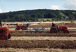
 Brockley ploughing match | |
| Location | |
| Grid reference: | ST471668 |
| Location: | 51°23’53"N, 2°45’37"W |
| Data | |
| Population: | 277 (2011) |
| Post town: | Bristol |
| Postcode: | BS48 |
| Dialling code: | 01275 |
| Local Government | |
| Council: | North Somerset |
| Parliamentary constituency: |
North Somerset |
Brockley is a village in Somerset, about three miles south of Nailsea, and includes the village of Chelvey. According to the 2011 census it had a population of 277.
History
To the west of Brockley is Taps Combe Camp, a Roman and Iron Age hill fort. The hill fort is shaped a lot like a "D", and is approximately 160 feet by 160 feet wide.[1]
Brockley was the location of a 300-person Prisoner of War camp during the Second World War, initially housing Italian prisoners from the Western Desert Campaign, and later German prisoners after the Battle of Normandy.
Geography
Brockley Combe is a wooded combe near the village. Bristol International Airport lies at the top of the combe. A minor road runs along the length of the combe, meeting the A370 at the lower end. The village is at the western edge of the Lulsgate Plateau, the Carboniferous limestone hills which form a northern outlier of the Mendip Hills.
Landmarks
Brockley Hall Stables, the former stable block of Brockley Hall, is designated as a Site of Special Scientific Interest (SSSI) because the roofspace hosts a large breeding colony of greater horseshoe bats during summer.[2] They are also a grade II listed building.[3] Brockley Hall was a country house dating from the late 18th century, which was remodelled around 1825 in a plain Greek Revival style for J.H. Smyth-Pigott. It has now been converted into four houses.[4]
Nailsea Court near Chelvey dates from the 15th century and is a Grade I listed building.[5]
Transport

The village is on the A370 between Bristol and Weston-super-Mare close to the Bristol Channel.
The village of Chelvey which is on the Bristol to Taunton Line with the nearest station being at Backwell. The parish is sectioned by the Bristol and Exeter Railway, now part of the First Great Western area.
Parish church
St. Nicholas' Church dates from the 12th century, and has been designated as a grade II* listed building.[6] The church is in the care of the Churches Conservation Trust.[7]
Church of St Bridget, Chelvey dates from the 12th century, and has been designated by English Heritage as a Grade I listed building.[8] Chelvey Court was built around 1618 to 1660 as a manor house for Edward and John Tynte.[9]
Outside links
| ("Wikimedia Commons" has material about Brockley, Somerset) |
References
- ↑ Everden, Shirley (August 2009). "Enclosure at Chelvey Batch, Broadfield Down Earthwork Survey" (PDF). Yatton, Claverham, & Cleeve Archaeological Research team. http://www.ycccart.co.uk/index_htm_files/Chelvey%20Y21%202010.pdf. Retrieved 15 November 2016.
- ↑ SSSI listing and designation for Brockley Hall Stables
- ↑ National Heritage List 1320637: Stables and Coach-house
- ↑ National Heritage List 1137543: Brockley Hall
- ↑ National Heritage List 1129104: Nailsea Court
- ↑ National Heritage List 1137608: St Nicholas' Church
- ↑ "St Nicholas, Brockley". Churches Conservation Trust. Archived from the original on 15 January 2010. http://webarchive.nationalarchives.gov.uk/20100115235726/http%3A//www.visitchurches.org.uk/findachurch/st%2Dnicholas%2Dbrockley/?region%3DSomerset%26offset%3D0. Retrieved 14 January 2010.
- ↑ National Heritage List 1129822: Bridget's Church
- ↑ National Heritage List 1312236: Chelvey Court and Bridge to the east and 2 outbuildings to the south-west
