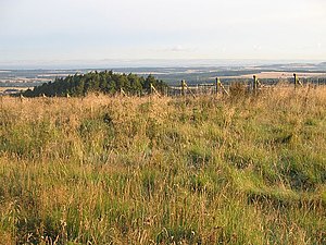
Soutra Hill
| Soutra Hill | |||
| East Lothian | |||
|---|---|---|---|
 On Soutra Hill | |||
| Range: | Lammermuir | ||
| Summit: | 1,207 feet NT459590 55°49’19"N, 2°51’52"W | ||
Soutra Hill is a hill of 1,207 feet in East Lothian, but which has been heavily scoured by quarrying for road-building material.
The hill is at the very edge of Lammermuir and is in the southernmost tongue of East Lothian projecting between Midlothian to the north-west and Berwickshire to the south-east. The A68, the main road which runs form the Lothians south down Lauderdale, climbs steeply over the hill the way south, curving around the north edge of the remains of the hill.
A prehistoric barrow has been identified on the summit of the hill, in the form now of a denuded cairn overgrown with grass, measuring 27 feet in diameter and reduced to 1 foot in height. The sherds of a vessel found in the cairn have been dated either to the Neolithic or to the Bronze Age.[1]
| ("Wikimedia Commons" has material about Soutra Hill) |
References
- Soutra Hill on Scottish Places
