Spout of Garnock
| Spout of Garnock | |
| Ayrshire | |
|---|---|
 The Spout of Garnock | |
| River: | River Garnock |
| Fall: | 70 feet |
| NS28706092 | |
| Co-ordinates: | 55°48’40"N, 4°44’7"W |
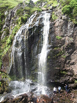
The Spout of Garnock is a waterfall with a drop of about 70 feet on the River Garnock in the north of Ayrshire. It is the county’s highest waterfall.
Here the infant Garnock, yet just a mountain burn, tumbles off the hill-top and into a gorge, through which the river courses for several miles.
The waterfall is close to the source of the river, which is about a mile and a half to the north-west.[1] Just above the source is the summit Ayrshire’s county top, the Hill of Stake, is a mile and a half north-west of the Spout of Garnock.
References
- ↑ Love, Dane (2003). Ayrshire: Discovering a County. Fort Publishing. p. 72. ISBN 9780954446116.