Ettrick Water


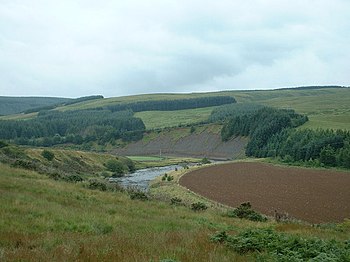
The Ettrick Water is a river in Selkirkshire, a river of the hills and upland moors, and a tributary of the River Tweed.
The Ettrick Water has given a name too to the Ettrick Forest, once a great royal hunting forest, though mainly denuded of trees today. "Ettrick Forest" is an alternative name for Selkirkshire.
Course
The Ettrick rises on slopes of Wind Fell (2,182 feet), at Selkirkshire's border with Dumfriesshire, and other headwaters on the neighbouring peaks on the surrounding county border, including Hopetoun Craig (2,073 feet) and Ettrick Pen (2,269 feet). Here the county boundary is a loop around the head of the dale, and it is marked by the watershed between east and west: the waters of the Ettrick ultimately flows to North Sea at Berwick-upon-Tweed, while those of the Esk on the other side of Wind Fell flow to the Irish Sea.
The Ettrick Water flows north-eastwards down to the village of Ettrick and down Ettrickdale, where the floodplain by the village is known as the Ettrick Marshes.
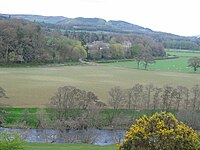
Below Ettrickbridge the river flows on beside small villages to the county town, Selkirk, below which its wild nature appears to tame itself a little.
A little north of Selkirk, the Ettrick casts its waters into the River Tweed.
The river may be known as Ettrick Water or the River Ettrick, and locally it is known oftentimes as Wild Ettick, a title once applied to the Ettrick Forest the valley