Annesley
| Annesley | |
| Nottinghamshire | |
|---|---|
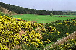
 Robin Hood Hills | |
| Location | |
| Location: | 53°4’38"N, 1°14’24"W |
| Data | |
| Population: | 1,162 (2011) |
| Post town: | Nottingham |
| Postcode: | NG15 |
| Dialling code: | 01623 |
| Local Government | |
| Council: | Ashfield |
| Parliamentary constituency: |
Ashfield |
Annesley is a village and parish in the Broxtow wapentake of Nottinghamshire, located between Hucknall and Kirkby-in-Ashfield. According to the 2001 census the civil parish had a population of 1,096, increasing to 1,162 (including Annesley Woodhouse) at the 2011 Census.[1] Nearby to the west is Annesley Woodhouse. Presumably the Annesley family, now spread worldwide, originally took its name from that of the village.
The privately owned Annesley Hall is a Grade-II listed building, once owned by the powerful Chaworth-Musters family and has connections to the Byron family of nearby Newstead Abbey. Annesley Old Church was mentioned by Lord Byron and D. H. Lawrence, two literary figures of importance who lived in Nottinghamshire. There is also close by the earthworks of Annesley Castle
The Misk Hills lie to the south of the village. Annesley is part of Nottinghamshire's Hidden Valleys area. The parish is grouped with neighbouring Felley (pop 4) to elect a joint parish council. The village primary school is on Forest Road in Annesley Woodhouse. There is a library in Annesley Woodhouse church hall on Skegby Road which is open three days a week. The old church of Annesley was dedicated to All Saints. It was allowed to become derelict in the 1940s. Features of interest included the east window of the south aisle, the 13th century sedilia and the 17th century royal arms in stucco.[2]
The village is situated on the busy A611 for Mansfield near junction 27 of the M1. Nearby to the south is the roundabout with the A608, which is now a thoroughfare to the large Sherwood Park Enterprise Zone.
It was once connected to Nottingham by rail, until Annesley railway station closed in 1953.
References
- ↑ "Civil Parish population". Neighbourhood Statistics. Office for National Statistics. http://www.neighbourhood.statistics.gov.uk/dissemination/LeadKeyFigures.do?a=7&b=11120022&c=Annesley&d=16&e=62&g=6456128&i=1001x1003x1032x1004&o=362&m=0&r=1&s=1459693053941&enc=1. Retrieved 3 April 2016.
- ↑ Pevsner, N. (1951) Nottinghamshire. Harmondsworth: Penguin; p. 27
Outisde links
| ("Wikimedia Commons" has material about Annesley) |
- Annesley and Felley Parish Council
- Nottinghamshire history
- Photographs of The Former Annesley Colliery Buildings
- Old Notts
- Annesley Castle
- Annesley Woodhouse Quarry Nature Reserve
- Annesley Colliery – photos taken in 2007
- Former colliery at Annesley Woodhouse
- Railway memories of Annesley yard and loco depot
- Annesley in the Domesday Book

This Nottinghamshire article is a stub: help to improve Wikishire by building it up.
