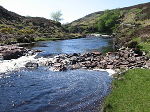
River Borgie

The River Borgie flows through the north of Sutherland to reach the sea in Torrisdale Bay, on the county's north coast.
The river first emerges from Loch Loyal, a loch lying under the eastern slope of one of the county's most famed mountains, Ben Loyal (2,510 feet), the loch itself being fed by numerous burns from the hills of northern Sutherland. The strem from the loch is immediately swallowed by another, Loch Croaggie, and then Loch Slaim, from which the River Borgie emerges, and runs in a curve two miles eastward before turning north, which course it then maintains.
The Borgie Forest, otherwise known as the 'Millennium Forest', lies along the middle course of the river and higher up into the hills. It was planted as a new afforestation project to mark beginning of the new Millennium. Below the new wood is the village of Borgie.
The river empties finally into the western corner of Torrisdale Bay, on the north coast of Great Britain, by Torrisdale hamlet and beneath a sheltering headland.
Location
- Location map:58°29’50"N, 4°16’58"W
Outside links
| ("Wikimedia Commons" has material about River Borgie) |
[Category:Rivers of Sutherland|Borgie]]
