Aberangell
| Aberangell | |
| Merionethshire | |
|---|---|
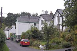
 Cottages in Aberangell | |
| Location | |
| Grid reference: | SH845098 |
| Location: | 52°40’26"N, 3°42’29"W |
| Data | |
| Post town: | Machynlleth |
| Postcode: | SY20 |
| Dialling code: | 01650 |
| Local Government | |
| Council: | Gwynedd |
| Parliamentary constituency: |
=Dwyfor Meirionnydd |
Aberangell is a village in south-east Merionethshire, adjacent to the border with Montgomeryshire.
It stands at the confluence of the River Angell and the River Dovey, both of which here form the county border. Some of the village lies across the Angell in Montgomeryshire. Aberangell had a passenger railway station on the Mawddwy Railway between 1867 and 1931, with freight carried until 1952. It was also the terminus of the narrow-gauge Hendre-Ddu Tramway.
Aberangell post office closed in October 2008.[1] In 1993 and 2008 Aberangell won Calor Village of the Year in Wales.
References
- ↑ "PO branch saved but 48 to close". BBC News Online. October 2008. http://news.bbc.co.uk/2/hi/uk_news/wales/north_west/7655487.stm. Retrieved 26 June 2010.
Outside links
| ("Wikimedia Commons" has material about Aberangell) |

This Merionethshire article is a stub: help to improve Wikishire by building it up.
